Category: Urbanism (page 2 of 3)

Figure Ground Development Patterns

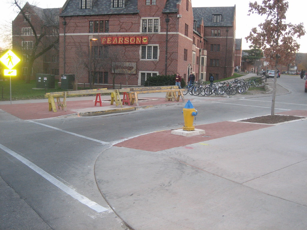
Figure-ground diagramming is an interesting and useful tool for analyzing spatial relationships in urban environments. It also provides a striking comparison of density and land use of older urban development compared to more contemporary suburban development. In older, urban places buildings typically took up the majority of space on a city block so even when diagramming built structure as figure (black) and space without structure (ground) the graphic would essentially depict the street grid. In more contemporary development however, auto-centricism has made for much more spread out buildings divorced from the street edge. Instead of relating to the street and sidewalk (if there even is one), these buildings related to their respective parking lots. Figure-ground diagrams of these sorts of places are often difficult to discern where roads actually go, but are very telling at the amount of open space wasted on the temporary storage of cars.

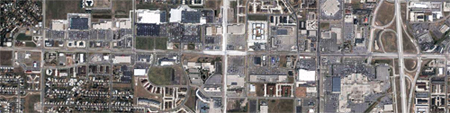
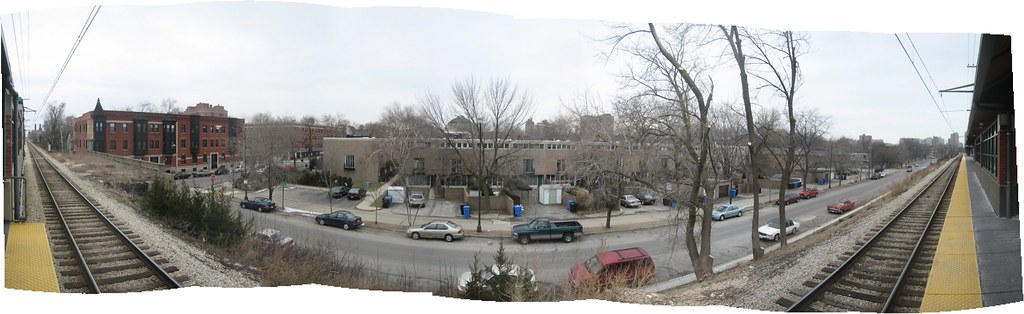
The figure-ground diagram above is an example of one of these suburban places that lack order and urban spatiality. They vast openness surrounding the buildings makes it hard to tell where roads go or even scale. The variety of building orientation in this case makes it even more difficult to decipher. In the image below, the roads are included, and we can begin to understand more about this space.

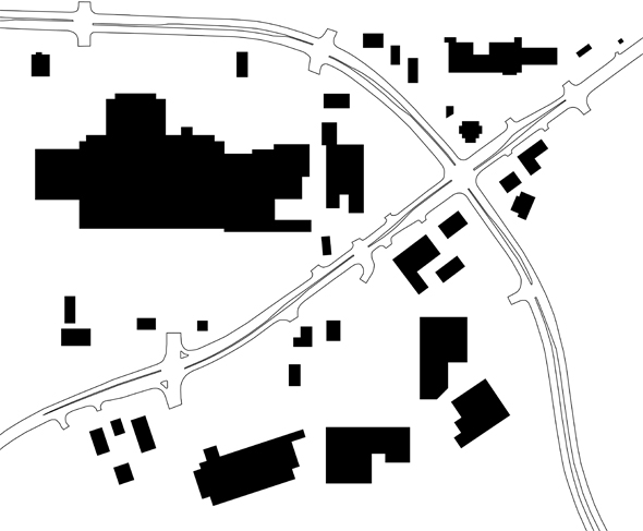
The diagram shown is of the Lindale Mall area in northeast Cedar Rapids, where First Avenue and Collins Road intersect. First Avenue is the road running diagonally from the lower left-hand corner up to the top right. I first decided to explore this area through figure-ground after noticing the actual corner of First Ave and Collins is very undefined. In fact, hardly any of the buildings in the study area relate in orientation or proximity to the street at all.

In the image below I stitched together multiple bird’s eye views from Bing Maps. The predominance of pavement stands in stark contrast with the lush green, tree-laden land to the south. The awkward angles at which big box stores were built, situated far from the street, combined with sloping terrain, makes for a very haphazard, almost disorienting, landscape. Driving along First Avenue, the only thing definite is that you are constantly surrounded by parking lot. Asphalt abuts the street the entire length, with only a few small outparcel structures even nominally close.

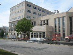
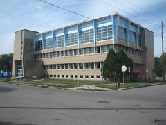
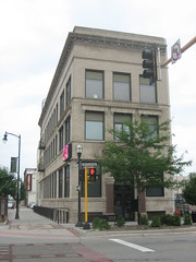
The area began developing in the 1960s, following the construction of Lindale Plaza, later enclosed as the indoor mall it is today. Besides Lindale, most of the larger scale retail developments there today were only built in the last ten years or so, as older properties were redeveloped. These recent redevelopment areas comprise a significant amount of the First Avenue corridor, and every single one disregards site context and has little relationship to the street. How unfortunate since these will ultimately remain for at least the next few decades.

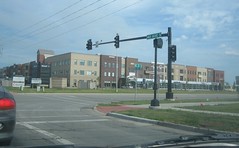
So why is this a problem? The chaotic development pattern makes finding particular businesses – especially while driving – more difficult, and is very inconvenient for pedestrians. Even if the area had a complete sidewalk network, going from place to place would take much longer on foot than if buildings were closer to the road. I also don’t think massive parking lots make for a very attractive street environment.

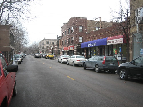
Now I’m not advocating no parking, but what if the placements of all these buildings were simply switched with their respective parking areas? If buildings were located by the street and parking placed in the rear, it would be more accessible and equitable to those arriving on foot, bike, or bus – while still serving car customers just as well. With buildings all along the street, it would reduce the distance between places, making it easier for people to get to multiple stores and restaurants in the area on foot. In the current setup, it’s likely most people will get back in their cars just to drive over to the next store rather than walking.

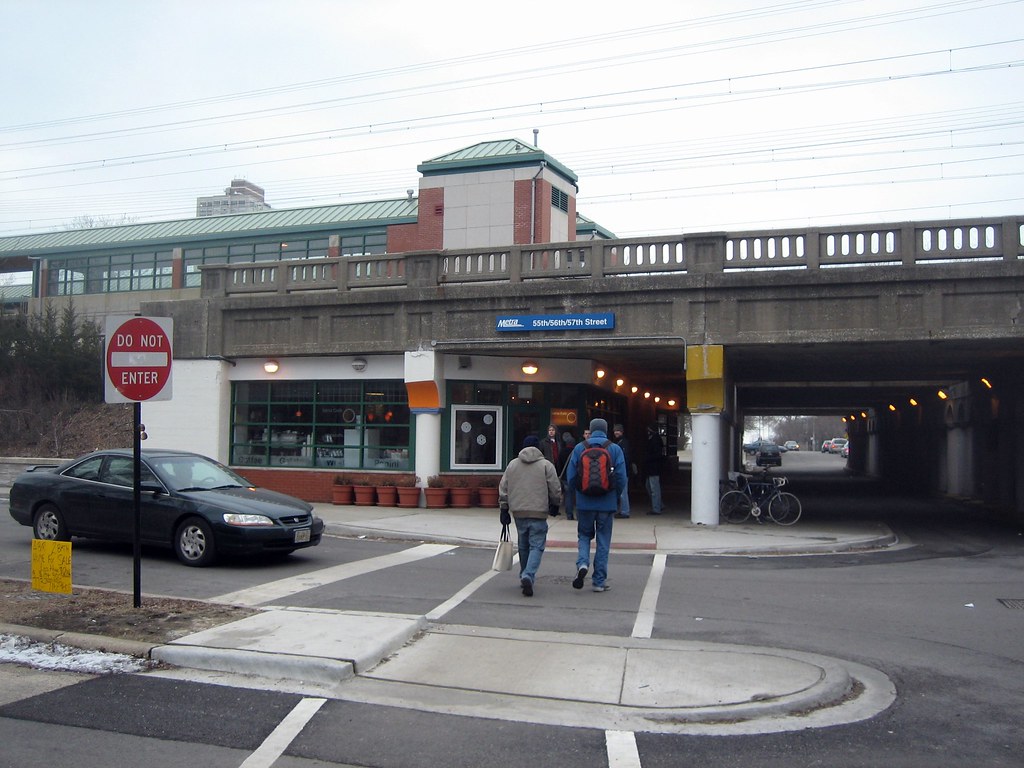
Aesthetically, the street would be much more attractive with a well defined edge. This would provide the area a stronger sense of place and urbanity, instead of the anonymous suburban scape that exists now. Distance-wise, the mall and surrounding development is really quite close to a large residential area, just a few blocks down First Avenue, but right now there’s not even a sidewalk from around 40th Street up until the mall, where then, there is only a partial sidewalk along the south side in front of Home Depot. Even so, if a continuous sidewalk existed, psychologically the perceived distance from nearby homes would be quite long due to the spread out configuration of buildings. Built-up density makes walking distances seem shorter, while vast open space – like parking lots – makes distances seem longer.

If newer buildings like Home Depot and Marketplace on First had been built up to the street, this area would already look and feel more dense and closer together. With a more urban scale, nearby residents may find walking or catching the bus (pending improved transit service) to be more convenient than driving the five or six blocks to the mall. Unfortunately the current setup encourages and almost necessitates driving.

I don’t expect this area to ever drastically change, especially since many of these developments are relatively new, but I do hope that other new large and small scale commercial developments will be more respectful of the street and accommodate customers arriving by all different modes equally. Urban design is not only about how the environment looks, but about how it is organized, oriented, scaled and proportioned. Good urban design can have a profound impact on the accessibility, usability, and sustainability of new developments.

Welcome to Stapleton

When I was in Denver about a month ago, I took a short driving tour around the newly established Stapleton neighborhood, a massive redevelopment project underway at the former site of Stapleton International Airport. The largest New Urbanism project in the United States (according to Wikipedia), Stapleton is designed to be a more sustainable, community-oriented, mixed-use neighborhood. I was eager to check out the progress.

Housing and Public Space
Green space was plentiful throughout the progressing development. A large Central Park is complimented by meandering greenways and tiny neighborhood parks. Streets are pretty much laid out in an efficient grid system with occasional deviation. Different areas sport different housing types and styles. Most are based on regional and traditional precedents and are all oriented toward the public street. Prices range from $80k townhouses up to $900k estate homes – view them all.

Stapleton brings back the alley, providing access to garages behind the houses. The fronts of these homes are no longer dominated by garages for cars, but porches for people. Most of the homes sit on compact lots so garages take up much of the back yard, so the front yard and neighborhood park spaces become the place for outdoor recreation and relaxation. This is believed to foster community and more interaction with neighbors.

Sustainability
Sustainability is a key focus of the new Stapleton neighborhood. Tangible measures include building all ENERGY STAR homes that are more energy efficient, some with solar panels; LEED certified office buildings; and recycling old runways and parking lots into new streets, bike paths and sidewalks. Additionally, nearly 27,000 new trees have been planted in Stapleton, and the new Central Park, greenways, and pocket parks have increased the amount of parkland in the city by over 30 percent.

Sustainability is not only about energy efficient buildings, but also planning, diversity of uses, and aesthetics that promote sustainable lifestyles and community. As mentioned above, streets are pretty much laid out in a grid system and connect at many points with the existing city road network. This is more efficient than the typical suburban road hierarchy of cul-de-sacs and short local streets feeding into collector streets and major arterials. Typical suburban subdivisions provide only one or two routes in or out, often making one walk or drive a longer distance due to convoluted curving roads and lack of thru streets. They also cost cities more to maintain because each street only serves a small number of residents. So grid street systems provide more direct access and route alternatives, distribute traffic more evenly, permit more efficient distribution of utilities and services, and minimize maintenance of excess roadways by maximizing the use per person of each street.

Proximity to places of work, stores, restaurants, and schools is also essential for a neighborhood’s sustainability. This reduces the need to drive so much for everyday needs and conveniences. Generally amenities within half a mile is an acceptable walking or biking distance.

Mixed Use and Retail
With over two million square feet of retail planned when completed, the Stapleton neighborhood certainly has a mix of amenities and residential. However, pretty much all the retail and commercial has been developed (and is planned for, according to Stapleton land-use maps) on the western edge near Quebec Street, so it is not as integrated with housing as it could be. Also a majority of the current retail is in the form of a dressed-up big box power center and a lifestyle center / mall, essentially your typical upscale suburban shopping center.

Current commercial and retail space is concentrated in three distinct main shopping districts. East 29th Avenue Town Center is the quintessential “main street” area so commonly found in New Urbanist developments. It is a relatively small area located on the west side of Stapleton along Quebec Street. Pedestrian scale one to two story shops and buildings are built up to street like a traditional downtown Main Street, with plenty of parking concealed in the back. This particular retail area is well connected to the new residential blocks, some right across the street. 29th Ave Town Center is at a main entrance into Stapleton along Quebec Street so it is able to serve both the newer residents of Stapleton and those of older existing neighborhoods across the street.

Another, less pedestrian retail area is Quebec Square, just north of the E 29th. Ave Town Center area on Quebec Street. It is a typic big box power center with Walmart, Sam’s, Home Depot and several national retailers and quick service restaurants. Although clearly car-oriented, there does seem to be effort made to maintain a grid of streets through the center and minimize the visual and physic disruption of massive parking lots by locating most buildings at corners and along the edge of roads. Despite it’s suburban nature, Quebec Square is still reasonably accessible from housing in the Stapleton neighborhood with connections via the street grid sidewalks – longer than a 5 – 10 minute walk for most residents, but quick trips could easily be done via bicycle.

One more major retail area is Northfield Stapleton, an open-air, lifestyle center shopping mall about a mile north of the center of Stapleton on the opposite side of Interstate 70. Following the trend, Northfield provides a faux Main Street shopping environment with decorative streetscaping and pedestrian scale store fronts. This is deceiving as the entire perimeter is surrounded with a massive parking lot and outlaying box stores. In satellite view, it appears the street ways through Northfield were designed for future expansion in mind – so the pedestrian storefronts could eventually extend beyond the original main street. Unfortunately these pedestrian friendly arteries will always end in a car-friendly parking lot. Despite the distance, there is no real direct pedestrian access from the residential areas of Stapleton to Northfield so inevitably even nearby residents will have to drive here.

One last retail center on the eastern edge of Stapleton is yet to be developed. Eastbridge Town Center, planned at the intersection of MLK Jr. Blvd and Havana Street will be 29th Ave’s counterpart. So eventually the residential core of Stapleton will be flanked by two pedestrian friendly commercial zones.

Walkability
Stapleton seems to be very walkable with appropriate pedestrian provisions and will only get better as the neighborhoods are filled in. However, my initial reaction was that residential areas were too segregated from commercial areas. I figured it’d be much more integrated and mixed. The distance between many homes and shopping would require at least a 10-15 minute walk one way, not bad, but perhaps not enough to keep someone from driving instead if the errand was urgent enough. A quick trip could be made by bike or frequent transit service though.

Transportation
Connectivity to the rest of Denver is also critical for the sustenance of Stapleton, as many residents are employed outside of the neighborhood. The neighborhood’s transit plan is pretty extensive with a bus hub planned with numerous direct routes to major employment centers throughout the metro. The future RTD train service to Denver International Airport will go through Stapleton, providing a direct connection to Denver’s expanding light rail system. See maps for more information about the neighborhood transportation and land use.

Lowry Neighborhood
Another mixed infill neighborhood was underway in Denver a year before Stapleton Airport even closed. I discovered Lowry, less than a mile south of Stapleton, on Google Maps, as they appear very similar in aerial plan view. Lowry is smaller than Stapleton at only about three square miles, on the former site of Lowry Field and Air Force Base. From quick Googling, it seems Lowry may be a bit more suburban in form than Stapleton, but still much improved over typical suburban housing. At about 80 percent build out, completion of Lowry is expected within a year.

All photos in this post are from Flickr user faceless b / EPA Smart Growth.

> Discover Stapleton (official website)

Back on Campus: NDSU

NDSU

A lot has been happening at North Dakota State University since I was a student there, my freshman year three years ago. New construction and improvements are being made on campus; NDSU’s downtown presence is expanding, and mixed-use development is picking up next to campus. When I was in Fargo about two weeks ago, I made sure to take a look around and see it all for myself.

Campus
NDSU’s main campus, on the north edge of town, has remained much the same since I was a student there. Of course, in the middle of summer it was certainly more lush and tidy than it is the majority of the cold school year. A couple major changes: the Memorial Union addition is finally reaching completion, and the President’s House right in the heart of campus has been torn down to be replaced with a better, presumably more prestigious home yet to be constructed.

Renovation and expansion of the MU began when I was there, so my memorial of the building was dominated by partial demolition, make-sift, temporary spaces, and excavation where once was a dated plaza and green space of adjacent Churchill Field. In fact, the only time I saw the pre-construction union and open space was at a campus visit in late fall 2004. The new exteriors are nice and modernized but generally underwhelming. The most prominant new facade, facing Churchill Field to the east, is large and distinctive but feels like a barrier between outside and in with only a subtle entrance in the middle. A simple new plaza finishes the outdoor space, complete with a stage for campus events such as Band Day.

Memorial Union addition

Since classes were not in session it was hard telling how successful the plaza will be on a normal school day. I imagine it will be used quite a bit by students and staff, assuming some tables and seating are installed. For a plaza on a budget, it is nice enough and should serve the MU and campus well.

Churchill Field further away from the building had not been restored yet. Unfortunately, my friend Matt tells me some of that space is going to become a parking lot. With a ball diamond fence still in place at the corner, this used to be a popular spot for students to gather for a friendly game of ultimate frisbee or football or just to relax. In my opinion, based on my experience of visiting campus before construction and attending during it, Churchill Field was the closest thing NDSU had to a central greenspace and I had hoped it would retain better than ever. Especially with the rebuilt plaza, it is the perfect space to highlight as the heart of NDSU. I think the parking lot will probably be kept minimal and to the side so a lot of the greenspace should be preserved, but its nonetheless disappointing and will detract from the beauty and definition of the space.

Memorial UnionAs for the inside of the Memorial Union, it was a typical modern student activity center. Most of the interior had been reconfigured, so much of it was hard to pinpoint what had previously been in the space. The expansion to the east (Churchill Field) provides a much larger, improved food court in the basement and general lounge area on the main level. Since these two levels are now much more expansive than they were before, they appear short and closed in since ceiling heights could not be raised. Overall nothing too exciting but the updated interior and improved amenities will be beneficial.

Other improvements on campus include new, modern wayfinder/map signs and an expanded MU bus shelter. Ceres Hall, which houses the Registrar, Financial Aid and other administrative offices is also undergoing renovations with a rear modern glass stairwell being added. Ceres is a beautiful old building that was in need of updating on the inside.

Emerging Campustown

A few new buildings have gone up along 12th Ave N, next to campus. Formerly old houses and empty lots, there are now two new, 3-story apartment buildings with ground floor commercial space, with the looks of a third one on the way. One of them, at 12th Ave and 17th Street, faces the side street and provides parking to the side with the vacant commercial space fronting the parking lot. The placement of the building and it’s relationship to the sidewalk and street is not preferable but at least is mixed-use.

The second new building, which is at 12th and Albrecht Blvd, closer to the core of campus, is a more urban development. It fronts the sidewalk along 12th Ave and takes up a majority of the width of the site, placing parking in the rear rather than the front or side. This will help build up the elevation along the street and hopefully eventually be apart of a denser, more urban-feeling, pedestrian-friendly street that will be signature of the NDSU campus and community. It is truly oriented towards pedestrians first and cars second – the way it should be right by a pedestrian-heavy college campus.

As we were walking by, the owner was working on getting Jitters Cafe ready to open for business in a week. He let us peek inside and said to come back for free stuff when they open. Next door a coming soon sign was posted for Jimmy John’s – a staple of any true campustown. Directly across the street from NDSU’s major academic buildings and library, this is certain to be a busy place at lunchtime and throughout the day when classes start up.

My friend informed me a fraternity house down the block will be demolished for another apartment building. So it seems this trend will only continue and NDSU might someday have a more urban, vibrant neighborhood with additional services and conveniences for students and visitors.

North of campus on 19th Ave N, where some auto-centric businesses and restaurants already existed, a fairly large, new mixed-use apartment building has gone up next to a reconstructed Stop N Go gas station. Despited being named the Stop N Go Center, it is an attractive building that increases density and mix of uses while blending well with the existing car-oriented strip that is likely to remain that way.

NDSU Downtown Campus
NDSU’s first downtown facility opened to students fall 2004 in the 100-year old Northern School Supply Building, renovated into studio, classroom and office space for architecture, landscape architecture, and art programs. The building is simply known as NDSU Downtown and provides some of the finest studio facilities in the nation.

My year at NDSU was the building’s second year of use. I had first year pre-architecture studio and drawing class downtown. The renovations left structural and mechanical components exposed, as well as remnants of the building’s past uses.

Richard H. Barry Hall - NDSU DowntownIn 2006, two more buildings were purchased to expand NDSU’s presence downtown. The former Pioneer Mutual Life Insurance Building at 2nd Ave N and 10th Street, is currently being renovated and getting an addition for a new home for the College of Business. The building, renamed Richard H. Barry Hall is to be ready for classes one year from now, according to a countdown on the College of Business’s website. A new business building had previously been proposed for the west end of the main campus on 18th Street, but was scrapped for the building downtown.

Klai Hall - NDSU DowntownAbout a block east of Barry Hall, the former Lincoln Mutual Life & Casualty Insurance Building is finishing up renovations and addition for more downtown space for architecture. Renamed Klai Hall, the building will bring the entire Department of Architecture and Landscape Architecture downtown, starting this academic year. Once all completed, 9th Street in between Barry and Klai halls will be closed and a greenspace will be created to form a mini campus. This is about two blocks north of the original NDSU Downtown Building.

It will be interesting to see the downtown campus when finished and how it will change the dynamic of NDSU’s main campus, as well as its affect on the downtown area. Already, developers are looking into more downtown housing for students and nearby businesses should certainly benefit. No student parking will be provided at the new campus, but transit service frequency between campus and downtown is to increase. Unfortunately many architecture students will still need to drive since they will be at studio well after buses stop running. It will be a good opportunity for increased transit use for businesses students and faculty overall, and will help invigorate an already successful downtown. Unlike the main campus where commercial and mixed-use development is starting to occur, the downtown campus is surrounded by it. Downtown campus will certainly be a vibrant and inviting place for classes and studio work, sure to attract even more prospective students.

Fargo Revisited

Last weekend (August 8-11) I traveled to Fargo, North Dakota, for my friend’s wedding. I attended my first year of college at North Dakota State in Fargo from 2005 to 2006, so it was nice to get back and see my old friends and the city that was my first home away from home. I was sure to make time to look around a bit and see what has changed. The city was just as I remembered it, but I quickly realized the character and qualities of Fargo that I had come to admire, especially in the older neighborhoods and downtown. It was sort of like coming home.

Fargo’s older areas – within a mile or two radius of downtown – have aged nicely. Matured tree canopies have formed over residential streets, turning these axes of movement into spaces of their own. Mostly modest homes are well maintained. Residential streets flow harmoniously into downtown – with large yet unintrusive MeritCare hospital on the north end and beautifully simple Island Park to the south. There are no significant physical or psychological barriers surrounding downtown so there is good pedestrian connectivity between downtown and nearby neighborhoods.

I visited downtown briefly the morning before I left town. I parked on the north end of Broadway near the old Great Northern depot and walked down to the GTC and then stopped by NDSU Downtown. Walking down the sidewalk I could sense the liveliness around me. Despite massive suburban growth out west and south, downtown is still successful and retains the community’s heart.

Two years ago I scoffed off Fargo’s downtown as minimal or less impressive than that of my hometown Cedar Rapids simply because it had less of a “big city” feel – and big city skyline – that I perceived back home. Of course now I realize human scale design, pedestrian-friendliness, and 24-7 vibrancy are the traits actually good urban downtowns, not superficial towers that likely contribute little to sidewalk activity. Even before the flood that devoured Cedar Rapids’ downtown, I believe Fargo’s downtown is still a more dynamic city center. While downtown Cedar Rapids is/was certainly a bigger employment center, most of those jobs are in the 9-5 office crowd. Fargo’s downtown seems to be much more diverse with a more significant retail and restaurant scene. They also didn’t tear down as many of their older buildings that give downtowns their historic character and human-scale.

13th Ave S, Fargo - West Fargo, ND

Away from downtown and the older neighborhoods, Fargo is booming to the south and west, furthering suburban sprawl far out in to the plains. 13th Ave S, west of I-29, and extending into the city limits of West Fargo is the metro’s principle shopping corridor. It is big box central, a landscape of asphalt and low rise retailers. For over two miles, the roadway is characterized by heavy traffic, cheap buildings, and very few trees. I actually didn’t go down the whole way while I was there, but my guess is that much has remained the same.

Woodhaven Plaza

There are signs of some more urban-minded development on the outskirts, like Woodhaven Plaza at 40th Ave S and 42nd Street S, a three-story, mixed facade building with commercial space and upper residential units for sale. Somewhat awkwardly, an enclosed glass walkway is juxtaposed against the front of the ground level storefronts, for the winter months. Even though this development is an improvement over the monotonous strip mall or big box, it is still includes a sea of parking, is not built up to the sidewalk, and is surrounded by typical suburban subdivisions. So while these developments make an effort to be more urban and amenable to pedestrians, the fact is most people will still arrive by car because it is still more convenient than alternative modes.

All in all I had a good time on my visit to Fargo. Its a nice community that I enjoyed being a part of. Read more about NDSU and Metro Area Transit in my following posts.

Reshaping Sioux Falls

The Sioux Falls Argus Leader ran a story last Sunday (July 20) on how residents and city planners are making changes in response to rising gasoline prices in the booming community. According to the story, “Sioux Falls residents increasingly are using bikes and scooters, catching buses and moving closer to their jobs as reality sinks in.”  It cites several Sioux Fallsians that parked the SUV for their bike, scooter, or bus pass instead, including Miss South Dakota USA 1978, Nadene Oppold, who has no car and says she doesn’t want one.  The article also presents New Urbanism and the idea of a community less auto-oriented and makes alternative transportation easier and more convenient.

Sioux Falls has been growing at a tremendous rate for the past 10-15 years, adding over 3000 new residents just since 2007.  The city limits have expanded also, with the majority of development suburban and auto-centric, abandoning Sioux Falls’ historic street grid and characterizing the whole city as one large suburb.  Not to say development in peer metros are any less suburban; simply the rate at which Sioux Falls is expanding, and all within the center city’s limits, authenticates the “one big suburb” depiction.  The fact that a significant and growing portion of the City proper has been developed in post-war low density, single-use fashion, its identity is no longer the downtown but in the sprawling expanse of monotonous subdivisions and “upscale” strip centers with ample parking.

Sioux Falls city planners are trying to change that image by changing behaviors and modernizing land-use rules. The 25 year-old zoning ordinance is being overhauled, “with an eye toward more green space and less concrete” and ultimately to make mixed-use, more compact, efficient development a bigger part of the city’s future growth.

Earlier this year the Planning Department conducted a “visual listening” survey called Shape Sioux Falls to determine a community-wide vision for land-use standards that will be integrated into the updated zoning regulations. I came across this survey a while ago and found it particularly interesting. It was a collection of over 150 images of examples of all the general land use categories (commercial, industrial, residential, etc.) of varying aesthetic quality, to be rated on a scale of -5 to +5 on favorability for Sioux Falls. About 1500 community members participated and results show preference for human-scale, vibrant streets; plenty of green space, and less design emphasis on automobile use. This was a good format for identifying and analyzing what the community values in new and existing development in the city.

While Sioux Falls is making progress, the future success of these initiatives will ultimately depend on the attitude of residents. While high gas prices have become more than just a burden, now an economical hardship for many, I believe this will lead to a positive shift in the way we develop and interact in our urban – and suburban – environments. Thanks to high fuel costs, transit ridership is up all around the country and people are consuming fewer resources and making more sustainable lifestyle choices. It’s good to see Sioux Falls adapting to these changes for a better city tomorrow.

Links
> “Gas prices change way Sioux Falls plans” Argus Leader
> Sioux Falls Planning Department
> Shape Sioux Falls Initiative

Exploring Hyde Park

Like I said, I was in Chicago a week or so ago visiting Hyde Park for a transportation node project for studio. Our project site is centered around 57th Street and the Metra station so this is the area I spent the most time in. This area was largely residential with just a few cafes, small bookstores, and grocery stores. We were in the neighborhood both Sunday and Monday to see any variation between weekday and weekend activity.

Hyde Park encompasses the campus of the University of Chicago, the Robie House, and the Museum of Science and Industry along with great parkland along Lake Michigan that was the site of the “White City” for the 1893 Columbia Exposition. The neighborhood developed starting in the mid 1800s around the Illinois Central Railroad which is the present day Metra line.

57th Street between Kimbark and the Metra tracks is a nice mix of small businesses, town houses and apartments, a school and a small park with a playground. It felt like a perfect example of a good urban neighborhood. The days of visit were very cold so not many people were out and about. I was drawn to the block by the school and playground; across the street is a small strip of businesses including a bakery, small grocery store and a floral shop among others. Although 53rd Street a few blocks north has many more businesses, this block serves as a micro-center for the immediate blocks around it. The park and school act as a public gathering space and the shops provided daily amenities, surrounded by dense but comfortable townhouses and small apartment buildings.

The blocks around 57th Street were not very busy early Sunday afternoon. There were a few dog walkers here and there and some college student indulging in childhood fun at the park’s playground. The couple of cafes and restaurants on 57th were open for business as well as a charming used bookstore. While looking around at the bookstore a few UC students came in to look at the store’s random stock of used suite jackets. Two women stopped in for a few minutes but decided not to buy anything that day; evidently they were regulars.

Expecting bustling streets during the weekday, Monday came with a bit of a let down. 57th. Street was not packed with pedestrians, but businesses and the school were running as normal. Vehicular traffic was slightly higher when we arrived back in the neighborhood around 9am. A cyclist was locking up his bike to a sign post. A woman parked her car to patronize one of the local businesses. Recess time – school children took over the playground that UC students had occupied the day before. As I walked by the corner cafe it was full and alive with a range from business people to blue collar. Today’s activity was very routine – just another morning in the neighborhood.

I really enjoyed the small neighborhood park. It had many pathways leading into the playground with long wooden benches placed to the sides. The benches were not the most attractive and the paths were not pristine but they proved functional and usable. I would choose this charming active, but imperfect neighborhood park over a lifeless, perfectly landscaped suburban park any day.

The Metra tracks form a physical and psychological barrier between the dense neighborhood of Hyde Park to the west and the open park space to the east along Lake Michigan. Walking from the neighborhood through the 57th Street underpass was like the entrance to Frank Lloyd Wright’s Robie House about 6 blocks away. Businesses and apartments were built up right against the Metra tracks. The overpass was dark and cool with multiple arcades of small arches and columns. The underpass is low and constricting, pushing one through the space. An opening above in the center provides relief, allowing some light in. On the east, one is released into the very open boulevard of Stony Island Avenue and Jackson Park. The monumental Museum of Science and Industry building can be seen beyond the park.

The Metra station and its overpasses over 56th and 57th streets are gritty and a little dirty. The platform provides wonderful views of the immediate blocks. It gives a glimpse into what the neighborhood might hold to a first time visitor like myself. A lot of trash and junk cars along the adjacent street give the impression that the neighborhood will be dirty and unkept. However that is not the case. The streetscaping and building facades along 57th and subsequent cross streets are pleasing and at an appropriate human scale. Homes and businesses open out to the sidewalk encouraging active streets and community interaction. Interestingly the implementation of a newer, modern townhouse project directly across the street from the Metra tracks challenges this common idea of where public activity should take place. Surrounding an interior courtyard, with garages facing the existing public street, these townhouse do not encourage the kind of street activity the older buildings and homes do. Many of the small garage and yard areas facing the street looked under-maintained and were scattered with litter. The whole area right around station felt barren and unwelcoming. I believe this is largely due to the orientation of these town houses.

The beauty of Hyde Park is in its diversity, of land uses and people. College students, life-long residents, rich and poor coexist in harmony here. The neighborhood’s massing and density benefits pedestrians, cyclists, and transit users, while still providing relative convenience for those with private automobiles. The sidewalks are pleasant and safe to walk on. The streets are narrow enough to not overwhelm pedestrians and cyclists yet wide enough to provide parking in most places. Hyde Park is a great example of a vibrant, sustainable, urban neighborhood – the kind of place where I would love to live and raise a family someday.

See all my Hyde Park and Chicago photos here.

New brick and chains on campus

New brickwork and barrier chains have been installed outside of Friley Hall and Union Drive Community Center (UDCC) on the Iowa State University campus. The new brick replaces large dead, dirt spots where years of heavy pedestrian traffic has done its toll. I am always happy to see new brickwork on campus instead of all concrete sidewalks. It gives the already beautiful campus added character and visual interest.

However I can’t say the same for the new metal chains. These pedestrian barriers are found all over campus restricting pedestrians to sidewalks as to prevent creating “cow paths” in the grass. A debate has sparked on campus after a Facebook group was created arguing over-use of these chains that many deem uglier than a few cow paths. I agree that some chains are necessary around campus but it now seems they are going up just anywhere and everywhere. These new chains between Friley and the UDCC look haphazardly placed amid a few small shrubs and a tree at either end. Mulch has been worn away around shrubs as thousands of students cut through daily going between Friley and the UDCC where a dining center is located.

In such a high traffic area the landscaping strip at UDCC would be more suitable as a small strip of brickwork, like what was just installed nearby. The two trees could easily be preserved and maybe even a third one added, with space in between finished in brick. This would allow pedestrians passage, require little maintenance, and enhance the entrance into the Union Drive residential community. Instead of restricting pedestrians from cutting through by erecting unsightly metal chains, the Department of Facilities Planning and Management should work to identify and respond appropriately to pedestrian movement around campus.

Believe in Baltimore?

We visited Baltimore on Wednesday, March 13, over spring break. We took the MARC Penn Line train from Union Station in D.C. to Penn Station north of downtown Baltimore. First of all, Union Station is truly a jewel among American train stations. It was at risk of being lost just a few decades ago, but today it is a vibrant center complete with specialty stores, a food court, and even a movie theater. It is definitely something Washington can be proud of and a grand entrance to the city.

The ride to Baltimore wasn’t too exciting, just a few suburban commuter stations and a stop at BWI Airport. Coming into Baltimore, the view was of endless rowhouses, empty streets, and masses of trash and litter aside the tracks. The platform at Penn Station is outside on the back end of the building and certainly is not the grand entrance into Baltimore like Union Station is to D.C. After walking up a flight of old, worn stairs a hallway leads to a large waiting area at the front. This space has some grandeur but there is no one there. With no restaurants or stores at the station there is really no reason for travelers to linger there much. The exterior of the station is pretty nice but there is a huge, ugly statue blocking it, standing tall in the center of a taxi drive-thru circle in front of the terminal.

Penn Station is located at the north edge of downtown, maybe 20 blocks or so from the Inner Harbor. We started heading south on Charles Street, which leads in to the “cultural hub” of Baltimore at Mt. Vernon Square. On our way there, most of the buildings were older of course, no buildings very tall at this point. Most of the sidewalks consisted of a haphazard combination of old bricks and concrete. The streets were not in the best visual condition either, most with numerous patches. There was not a whole lot of activity in this area but there were a couple buildings we past that were being worked on for renovations, so that is a good thing.

At Mt. Vernon Square, Charles Street divides into two sides and a narrow green space exists between it. In the very center is the Baltimore George Washington Monument, actually built before the one in D.C. It is basically a round tower with a slightly wider, circular base. It was actually open and we were able to walk up a long spiral staircase to the top where there are windows to look out over the city. The interior of the tower had a lot of writing on from past visitors, but the exterior and base of the monument is well kept, which really is the most important.

Mt. Vernon Square is surrounded by the Peabody Library and a number of other museums and cultural elements of Baltimore. At the northeast corner of the square sits the historic Mount Vernon Square United Methodist Church made with various types and colors of stone, including green serpentine marble, giving it a dark green/brown appearance. It’s towering steeple at the corner gives the square two visual high points. Mount Vernon Square is certainly nice but for being the cultural and in some sense, the “best” part of Baltimore, it could use some improvements. In general much of the green space, especially north of the monument is featureless and not really utilized. Since the most surrounding buildings aren’t more than five or ten stories tall, the space feels very open and almost vulnerable. Being fairly close to the barren area around Penn Station and a freeway slicing through just a couple blocks to the east, the square is not as cozy and secluded as I would like.

Heading further south to the harbor, we entered the more built-up core of downtown with more skyscrapers, some old and some newer. The massive Charles Center complex stands out like a soar thumb and looks completely mix-matched and awkward. It was an urban renewal project back in the day, including office and residential towers. One Charles Center is the prominent office building, designed by Mies van der Rohe. Usually I’m not a big fan of Modernism, but I really don’t mind this one, especially in contrast with the other buildings in the complex. A few of them are starkly unattractive, especially one of the residential buildings that appears more like public housing projects than desirable apartments. Another slightly newer residential building reminds me of a retirement home in Fargo, only much taller.

Much of the complex is situation at an angle to the historic street grid and there aren’t any through streets through the super block it took for itself. The angles of the building create confusing inconsistency on the traditional grid of downtown and the city as a whole. It also makes the skyline view a bit awkward if you ask me. At the base in the center area is a low rise, newer development that doesn’t seem to belong at all. Like the rest of the Charles Center, it gives little respect to the street grid and forms its own random public space in the front. The building it self looks like a short suburban strip center without the parking. There is no defined roof level with a bunch of haphazard elevated portions, I imagine for mechanical purposes. We walked through part of the super block, which was quite inactive in the middle. Perhaps they shouldn’t have closed off the streets…

Note: This is an incomplete post.
See all my photos of Baltimore here.

Fear the Turtle


Well it’s now been three weeks since spring break. I haven’t been doing well posting about it in a timely manner, but better late than never. Three weeks ago on Tuesday, March 12, we took the Metro to College Park and explored the University of Maryland campus. The University of Maryland, College Park is the flagship university of the University System of Maryland and is considered a “public ivy” school, ranking quite well for a public institution. I am considering Maryland for graduate school in urban planning once I finally complete architecture school in 2011.

The College Park Metro station is a suburban commuter station, complete with a parking garage. It is somewhat disconnected from campus and the city itself. We walked about 15 minutes along Paint Brach Parkway before arriving at Route 1 / Baltimore Avenue, the main drag through town, and the front of the university. We continued into campus along Campus Drive and passed the big “M” in flowers in the center of a traffic circle. From there we went by the McKeldin Mall, the heart of the university and campus. It is much larger than I had expected and a lot hillier. The campus slopes up quite significantly from Route 1 on the eastern edge. The Mall was very active with many students relaxing or playing frisbee. This is definitely a very usable space on campus.

On the east end of the Mall is the Main Administration Building and on the west end is the McKeldin Library. Numerous academic buildings line the sides, all in dignified Georgian architecture. An allee of trees on each side of the Mall creates two formal walkways. They are retreatful and intimate in contrast to the wide-open Mall. In the center of the Mall is the 250-foot long ODK fountain, which water flows down various levels following the downward slope of the land toward Main Administration. Walkways radiate out from one end of it and many benches are placed along its sides. Unfortunately there was no water in the fountain yet for the season.

The Architecture Building is a newer, non-Classical building built in 1971. Clad in brick, it appears somewhat dated but is not too bad. Located just southwest of the McKeldin Mall, it is away from the more historic part of campus, but not totally disconnected either. Behind it is a large parking lot at the backside of campus. The building seems pretty small, almost too small to accommodate the whole department. I’m not exactly sure how much all the programs in the college actually utilize this building though. Inside the main part is a two story open space with classrooms on the second level and open studio space on the lower level.

We ate lunch at the food court in the Stamp Student Union, just north of the McKeldin Library. The food court is located in the center and is easily accessible from the outside. Unlike the food court in Iowa State’s MU, it is not hidden away in the basement and also offers many more choices, not just made up franchises operated by dining services. After lunch we walked around Byrd (football) Stadium and some high-rise dorms behind it. The high-rise dorms are extremely plain, somewhat resembling housing projects. However they are clad in brick and the entrances include some basic Classical elements.

Overall, the Maryland campus is very unified and distinguished. Most buildings were designed with Georgian or Classical architecture and new buildings continue to respect that. A few newer buildings are notably simpler, especially some of the dormitories as mentioned above, but nearly every building is clad in brick. One could argue that campus lacks architectural diversity, but I appreciate the consistency and the Classical charm it preserves. Additionally, it helps prevent a lot of fad architecture (such as modernism) being built on campus, which usually are not timeless and eventually considered unattractive.

The University of Maryland campus is certainly impressive, but the same cannot be said for College Park. We didn’t venture very far away from campus, but there is very little that surrounds it. Downtown College Park is along Route 1 at the southern tip of campus. It is little more than a few blocks of small strip buildings with typical college town businesses. In that regard it is somewhat analogous to Campustown in Ames, but it was much less active and less built-up. The fact that it is just a small stop along Route 1 in the sprawling suburbs of Washington doesn’t really help. Fortunately there does seem to be some hope for College Park. The University is in the works of a large redevelopment project on land across Route 1 from campus. The East Campus Redevelopment Initiative will replace a number of maintenance and university service buildings with a dense, mixed-use neighborhood. Hopes are that this will improve College Park for both students and residents, transforming it from a lackluster suburb to a vibrant college town. There are also a number of other developments underway in College Park and surrounding. More information is available at the Rethink College Park blog, which I enjoy reading.

See all my photos of College Park here.

A Day in New York City


On Monday, March 12, over spring break, we visited New York City for a day. We took a charter bus from D.C.’s Chinatown early in the morning and arrived in New York’s Chinatown a little after noon. It was my first time to Manhattan so it was quite exciting. The view coming into the city was less than attractive, however, as the New Jersey side is full of industrial sites and power plants. I guess they need to be somewhere in a metro of over 18 million.

Getting off the bus in New York City’s massive Chinatown was a bit disorienting at first. Unlike Chinatown in Washington, it is much more authentic and gritty. Thousands of tiny retailers and restaurants are packed into shared buildings, generating an almost overwhelming experience of so many different things to look at and see. We walked a little bit until we found a subway station near the courthouse in the financial district. On our way, we passed filming for Law & Order in front of the courthouse. Interestingly, everyone around the production went on their way as if it were nothing special.

The New York City Subway was quite the experience with some obvious differences between it and the Washington Metro. Station entrances don’t seem to stand out well and, in many locations are simply staircases along the sidewalk. Hence, much of the NYC Subway system is not wheelchair accessible. All the stations we visited appeared a little bit different, but still notably similar. Entering most of the stations began with a walk down a staircase before arrive at institution-like gates to pass through. Past the gates, additional staircases or in some stations, ramps continue to the platforms and tracks. The stations were unrefined, cramped and grimy. They are much more exposed than the newer Metro system in DC, with exposed structural beams between the platform and mezzanine levels. The system itself is of course much larger than the Metro and so it is more complex. Instead of simple rail lines, there are many interconnected lines throughout the city and then different trains making various routes along the different lines. Some trains were express, stopping at only a few stations along the line, which is a feature that would be nice in D.C.

Our first stop was at Grand Central Station, where we continued on foot in Midtown Manhattan, passing Bryant Park and eventually reaching Times Square. Like I said before, no place I visit is quite how I expect it to be. Even Times Square was a lot different in person than what I had expected. First of all, the orientation of Times Square surprised both Spencer and me. The typical broadcasted view of the New Year’s Eve ball drop and the large Panasonic television screen is actually looking from north to south. We both had always assumed it was a northward view and expected that same sight as we approached Times Square.

We continued on to a few side streets and walked all the way up to the new Time Warner Center at Columbus Circle and the southern edge of Central Park. The north-south avenues were wide and busier than many of the east-west streets, which are placed closer together. Times Square is of course very complex and flashy, but some of the side streets were actually quite void and lacked much vibrancy. The whole area is impossible to take all in all at once so I didn’t even attempt to. In general, retail, restaurants, and service businesses utilize most of the buildings. I found it interesting how almost tacky many of the buildings were, most being very old and reused for so many different activities. It seems as if that is acceptable there, that individual buildings don’t really have to look real nice, because they’re already in New York. Since New York has no problem attracting new residents and visitors, they don’t need to be as strict about those sorts of things and tourists and residents alike will accept those traits as unique character of New York. As a visitor, I find it interesting and compelling, but if I were a resident, I’m not sure to what extent I’d admire it.

Next, we headed to Rockefeller Plaza where we went to the “Top of the Rock” observatory. It has a couple different levels and offers magnificent views of Manhattan and the surrounding area. The bustling city of New York below seemed so quiet and serine from up high. Once we got back down, we briefly stopped by Central Park and came out in the Upper East End.

The Upper East End is very well kept and notably more sophisticated than Times Square and Midtown. As the evening approached, we took the subway back to the Financial District where we came out right by City Hall and the Brooklyn Bridge. Here we walked part way up the Brooklyn Bridge and then around Wall Street and Ground Zero. Unfortunately my camera battery died about now, so I wasn’t able to get many pictures of these areas.

We got back to Chinatown around 8pm, as many businesses were closing for the evening and many others receiving deliveries. Our bus departed about 9pm, and we were on our way. To our pleasant surprise, the bus stopped briefly in downtown Philadelphia and dropped off some passengers in Chinatown there. It was noticeably smaller than New York City’s, but definitely more real and authentic than D.C.’s. It was late so downtown was pretty lifeless as we past through. Heading back, we also drove past Wilmington, De. in the distance.

All in all, it was a pretty neat day in New York City. It’s impossible to see everything in just one day, but I think we did pretty well in the time we had. New York is a great city and truly an international center. However it seems very impersonal and too large to conceive. Unless perhaps you were born and raised there, I can’t imagine ever being able to fully adopt it as one’s home. It is simple to huge to fully embrace. I enjoyed visiting New York, but it is not the place I’d like to call home.

See all my photos of New York City here.

Older posts Newer posts

© 2022 URBAN THINKING

Theme by Anders NorenUp ↑