Category: Exploring (page 3 of 4)

Spring in Rome

I arrived in Rome earlier today (Thursday) for a semester study abroad with about 55 other students from my class. We are staying in apartments in the middle of the city and the College of Design has studio space just across the river at Piazza delle Cinque Scole. The semester goes till the end of April, after which I plan to travel about 10 days and return home from London on May 11.

My flight schedule began in Cedar Rapids and went through Detroit and Amsterdam on the way to Rome. All my layovers were quite short, but Detroit and Amsterdam both have very nice airport facilities. I landed at Rome’s Fiumicinio Airport a little past noon today. The view coming in for the landing was like a painting, seeing rolling meadows spotted with old cottages along the sea line. The airport, at least the part I experienced, was quite unimpressive. My plane did not pull up to a gate, rather we exited far way on the tarmac and took a bus to baggage claim.

I met a couple of my classmates and we took a taxi into the city to our apartment to check in. The ride was a great first look around the city. Most of our apartments, including mine, are in a former convent, now housing study abroad student apartments as well as those for the general public. In the middle is a great courtyard. Every corner there seems to be another nook or passageway to discover. We found a stairwell up a roof top terrace, complete with kitchen and a terrific view of the surrounding city.

I look forward to spending the next four months in Rome, learning and exploring through studio and classes, as well as getting to understand the city. It is an incredible change from the normal urban arrangement in America and the term “old” takes on a whole new meaning. Almost everywhere is remnants of past centuries. The interaction between these ancient structures and and new infrastructures for a modern polis is fascinating.

I hope to post much more as I get to know the city better and report on my work in studio and other explorations. I started a new “Rome” category that will contain all these relevant posts to come. Ciao.

DC Chillin’

I returned last Tuesday from a week in the Washington, DC, area. My friend Cece and I went to visit another friend Spencer, who goes to school there. This was my fifth time to the nation’s capital, while it was Cece’s first, so it was a good mix of seeing different neighborhoods and the obligatory museums and monuments.

We flew into BWI Wednesday, Aug 5, and took the MARC Penn Line to Union Station in downtown Washington. All previous times visiting I’ve flown into Reagan National Airport, which is literally across the river from DC, in Virginia. It has Metro service on the Blue line so getting into the city is a breeze. From BWI, we first had to take a shuttle bus to a remote parking garage where the MARC stop was at. Then we waited about twenty minutes for the train; meanwhile a few Amtrak Acela trains zoomed through. It look 30-40 minutes to get to Union Station in DC. Our first day was spent just walking around downtown and the Mall area.
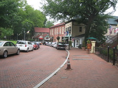
The next two days, Spencer had reserved a Zip Car, so we ventured into Maryland and Virginia, far beyond the Metro lines. On Thursday we drove to Annapolis and spent a few hours exploring the historic capital city and enjoyed a delicious lunch at a local seafood restaurant, Backyard Bar & Grill. Annapolis is a beautiful place with brick everywhere. The scale and density of buildings in the city’s historic center is so unusual compared to what is typical in much of the country, particularly outside the east coast. On Friday we went to Shenandoah National Park in Virginia, where we took a nine mile hike up Old Rag Mountain.

Saturday morning we spent a couple hours at museums and the National Mall. In the afternoon we had a corn party grill out at a townhouse in Georgetown where a friend of Spencer’s was getting ready to move out of. It wasn’t “Iowa sweet corn from the back of a pickup truck” but it was good nonetheless. On our walk back to GWU, we passed through the new Georgetown Waterfront Park, along the Potomac River that most recently was used for parking lots. It was refreshing to see a modern, urban park in Washington, where most public spaces are decidedly more formal.

That evening we went to a Nationals Game at their brand new stadium on South Capitol Street by the Anacostia River. I’m normally not a huge fan of baseball, but I enjoy the atmosphere and it was neat to see the new stadium. The area surrounding the stadium is undergoing intense redevelopment with a number of new, large office buildings replacing mostly run-down housing.
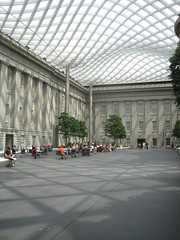
Sunday was spent visiting a few other museums including the Renwick Gallery and the National Portrait Gallery, neither of which I had been to before. The Renwick, sitting at the corner of Pennsylvania and 17th, just across the street from the White House, had a delightful collection of American folk art. At the National Portrait Gallery I enjoyed seeing the infamous presidential portraits and WPA era paintings. In the middle of the museum is an enclosed courtyard (see image to left) with a beautiful undulating glass and steel ceiling. Designed by Norman Foster and constructed in 2004, it reminded me of the Great Court at the British Museum in London, also designed by Foster. Despite being an extremely hot day outside, inside the courtyard was very comfortable. With a cafe and lots of seating it would be a pleasant atmosphere to have lunch or meet someone for conversation.

Capitol Hill
That afternoon we took a walk around the neighborhood of Capitol Hill, stopping by the recently reopened, historical Eastern Market which was severely damaged by a fire in 2007. Inside the building is mostly meat counters and perishables, while other market vendors set up along the exterior and a parking lot across the street. The market was closing up for the day, but I managed to get inside behind two other explorers to see the refurbished space. We then headed further east along residential streets. Away from Pennsylvania Avenue the neighborhood is almost entirely residential, with a few corner stores, laundromats, etc. every here and there.
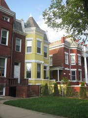
Nearly all the housing here is in townhouses, mostly attached. Unlike older neighborhoods like Georgetown and remaining houses closer to downtown, this area had a little more room to breath. On many streets the houses were actually set a good distance (10-25 feet) from the sidewalk so they had private front yards. We all agreed it would be a nice place to live. It has historic charm with strong urban qualities, but calm streets with tree shaded sidewalks.

On our way back toward downtown we walked a few blocks north up to H Street NE, where rail tracks are being laid for one of DC’s new streetcar lines. H Street is a wide, commercial street with a mix of large and small storefronts, some newer strip centers, and an unsightly public storage facility. Most businesses were gated up and closed for Sunday. Despite its seedy appearance, H Street is up and coming, and the streetcar line should help accelerate even more improvements.

Rosslyn – Ballston Corridor
Monday morning I went on my own to explore the Rosslyn-Ballston corridor in Arlington. I took the Metro out to Ballston and then started walking. As walking around became tiring, particularly in the 90 degree heat, I grew apathetic to explore much more. The massive extent of metropolitan sprawl here clearly can not be comprehended with one week visiting and walking around. Outside of the District, the non-gridded, non-contiguous urbanized region goes on for miles. There are many instances of urban form outside the city, some new and artificial, and some long established. It is a very different scene than metropolitans, large and small of the midwest. Admittedly, I would love to be able to drive all around this area in a car just to get a better comprehension of what the many places and spaces in between are like. Looking at a map or even satellite images is simply insufficient to grasp, and one certainly could not see everywhere by transit either.

Most of the large office buildings are clustered within 2-3 blocks to a few major thoroughfares. Despite wide, busy roadways there are wide sidewalks with decorative streetscaping, a good amount of pedestrian oriented ground-level businesses, and a general feel of real urbanism. In a couple places I strayed off the main road by a few blocks to see the “real Arlington” where large office buildings quickly transitioned into single-family residential. A lot of the houses were characteristic of mid 20th century East-coast suburban development, mostly with brick veneers in reverence to the more traditional Colonial Revival style. On other streets, though, homes were more characteristic of late Victorian and craftsman, that are common in older neighborhoods around the midwest. Some homes appeared to be renovated or possibly completely new, some keeping with the craftsman style, with others more contemporary, as pictured to the right.

I met back up with Spencer around lunchtime, while Cece was spending more of the day visiting museums. We went up to U Street for lunch and continued walking north passing through Meridian Park, all the way to Columbia Heights Metro. The station is located by a major retail center on 14th Street NW. The DC USA development includes a Target store, Best Buy, Staples, and fitness club among other stores and restaurants. I have always found big box retailers in urban contexts very interesting, so this was fun the check out. Target seems to be leading with many urban stores around the country, and inventive architecture at their newer suburban stores as well.

Silver Spring
After this we hit up Silver Spring, another major “downtown” in the region, just outside the northern limits of DC. Silver Spring, along with Bethesda, is one of the shining stars of Montgomery County, Maryland. Amidst more single family housing, the urban business district merges subtly with surrounding neighborhoods. A major destination is “Downtown Silver Spring”, a former enclosed shopping mall that has been mostly redeveloped into urban blocks of retail storefronts. A plaza area and fountain on Ellsworth Drive, the mainstreet of “Downtown” acts as a centerpiece. But downtown Silver Spring is much more than this shopping mall disguised as authentic urbanism with many additional businesses, restaurants, and housing in new and old buildings.

Near the “Downtown” shopping area, an open half-block lot had been artificial grass turf for a few years and was quite successful as public space, where people gathered and children played. I remember visiting the turf in 2007, and was surprised by how active it was. Now the site is under construction for a new Silver Spring Civic Building on the far end of the site with a Veterans Plaza in place. The plaza will act in many ways like the turf did, as a public space for people to gather informally and for events, such as the Silver Spring Jazz Festival. It should be noted Silver Spring is not actually an incorporated city and is governed by Montgomery County. There are few incorporated cities in Maryland’s Montgomery and PG counties that surround the District, but many places are considered towns or cities informally, such as Silver Spring.

National Cathedral
Tuesday, our last day in DC, we took a tour of the National Cathedral in northwest DC. It is an incredible building with several unique and characteristically American quarks. While most cathedrals were built hundreds of years ago, this one was only completed in 1990, after a long construction span of 83 years. Imagery and symbolism represent not only historic Christian stories and ideals, but also include modern elements of national and cultural significance. For example there is one stained glass window illustrating the solar system with a real moon rock brought back on Apollo 13. Also there is a discrete gargoyle of Darth Vader, expressing pop culture contemporary with the cathedral’s construction.

The cathedral is not directly adjacent to a Metro station, so it afforded us a short walk through a quiet residential area from the Cleveland Park station to the east. The walk back was quite a bit longer with a missed turn on the way to the Woodley Park – Zoo station, one stop south of Cleveland Park, for reasons none other than to see something different than the walk there. Nevertheless it was interesting to see a less dense, yet undoubtedly stately residential area of Washington.

Rockville Town Square
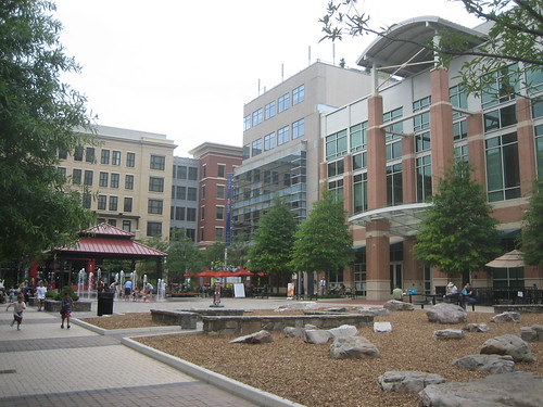
When back to the Metro, we rode up to Rockville, a few stops out into Maryland. I was interested in seeing the Rockville Town Center redevelopment that commenced in 2004, to replace a long ailing shopping center that in a previous decade replaced the city’s original downtown in the name of urban renewal. Much of the mall was torn down, with parts of it remaining that include a row of restaurants and a movie theater, though it’s not obvious to the unknowing visitor that it used to be a mall. Phase 1 of the town center project was Rockville Town Square, a four block area that has been built up with urban-scaled buildings connected with the existing town street grid with a wonderful public plaza as its focal point.
The view from the Rockville Metro station gives no indication of a walkable, welcoming urban space just a few blocks away. The Rockville Pike thoroughfare creates a minor barrier, along with a large, bland concrete office complex. A semi-enclosed pedestrian bridge over the road at least provides a safe means to cross on foot. We actually crossed the road on foot, not knowing exactly where the town square was, and passed the large office structure to where you could get a glimpse of something more humane and inviting. From our approach, we first came to the old mall remanence containing some restaurants and cinema, a block before the actual brand new development. I could tell this strip wasn’t as new as the town square developments. Across the street from the restaurant row is a large parking lot taking up the entire block. New buildings in the town square development were on the other side of the parking lot, so we headed in that direction.

The actual Rockville Town Square plaza is surrounded by the new buildings, all around five stories tall, so it is almost hidden. The new buildings stand in pretty stark contrast with existing Rockville Buildings that are mostly bland concrete boxes and towers. One calmer city street goes right through the town square development, where it becomes much more decorative and pleasant. With relatively narrow street widths and buildings built up to the sidewalk, the town square is revealed and opens up as you approach it.
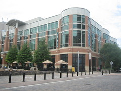
The square was quite active today. There were a few restaurants facing the square with outdoor seating. Others were eating or just relaxing on one of the many benches and seats. Kids were playing in the fountain. We got burgers at a Five Guys and ate on one of the benches. Besides retail and restaurants, and of course apartments and condos on upper levels, a major tenant at the town square is the Rockville Public Library, also in a brand new building. The two-story library building is situated at the corner of the plaza next to the one traversing street. At the corner on the first level is a restaurant. The actual library entrance is on to the square. Inside is a large two story atrium with stairs to the second level. One exterior facade is undulating, giving the library a fun and modern aesthetic, standing out from the other more traditional looking buildings around the square.

I really enjoyed visiting Rockville Town Square. Despite being brand new, it felt mostly like real city streets, real public space, not like a corporate “town center” shopping mall or completely separated New Urbanist development. With that, it felt a little hidden away behind larger, existing buildings and barriers like the Rockville Pike. Also since the town square is almost fully enclosed by new stylized buildings, it seems almost isolated from the rest of the actual city. But if this form of redevelopment continues I imagine it could provide a better connection between the square and surrounding neighborhoods. I look forward to visiting Rockville again someday.

Overall another enjoyable visit to DC and surroundings, though my past two visits were in March, so I wasn’t quite ready for the extreme heat and humidity. I think DC would be a neat place to reside someday, so whenever I visit I try to see different places and experience what it could be like to live there. I like to see the different neighborhoods and different lifestyles they encourage, because the city is much more than monuments.

See all photos from the trip on Flickr. By the way, the title of this post refers to this.

About New York

About five weeks ago, now, I went to New York City for a third year arch studio field trip. Now that it’s spring break I believe I have some time to write about it in more detail. The trip was Thursday, February 5 – Monday, Feb 9th.

We flew out of Des Moines at 6am, Thursday with a quick layover at O’Hare, arriving at LaGuardia in NYC shortly after 11am Eastern. Flying in over the city was amazing. Once on the ground we went outside on the frigid, but sunny day and waited for our shuttle buses to the Westside YMCA – our quality lodging for the trip. The ride took probably around a half an hour and was a sensory overload – so many little buildings, big buildings, different people, hundreds of side streets to peer down. I ended up dozing off briefly once we arrived in Manhattan as I got very little sleep that night before.

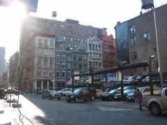
After the charade of checking in and assigning rooms to sixty plus arch students and profs we headed down to our project site in SoHo at the corner of Broome and Crosby streets, just east of Broadway. This project, that we are currently working on now in studio, is for a 24-unit residential development with a public / community / commercial component at ground level. The site is currently a double stacked auto park operation in an open lot about 110 by 70 feet. As individual studios we took about an hour to document the site and surroundings through observation and photos (later turned into photo stitches used to size and build four separate 1/8″ scale physical site models – one for each studio). Unfortunately it was extremely cold this first day, despite the sun, so I don’t believe the site visit was as effective as it could’ve been.

Following documentation we broke into studios and went on a walking tour of the area with our respective profs. This area was near the convergence of Little Italy and Chinatown. Along Broadway there are trendy retailers at the ground floor of older buildings with upper floors generally residential.

That evening after finally regrouping, some friends and I walked down Broadway from the Y (only about 15 blocks from Times Square) to find something for supper. We went through Rockefeller Center on our way and ended up eating at a pizza joint nearby that I had eaten at previously when Spencer and I went for a day two spring breaks ago. Big slices for cheap, can’t argue with that. After we ate we kept on toward Times Square – pretty sterile, predictable, not much to say. One thing to make note of, however, the recently opened red tkts stairs held up by structural glass. I was very tired so I ended up calling it a night by around 10, which I felt was a little unfortunate for my first night in New York, but was glad I did the next day.

Day 2, Friday, I went on an option tour / trip to New Haven, Connecticut, to see some significant buildings at Yale University. We took the Metro North commuter line from Grand Central – an enjoyable hour and a half ride, passing through upper Manhattan and New York and various stops in Connecticut. I really enjoyed New Haven, the first smaller, established city I’ve visited on the east coast (all the others have been large – DC, New York, etc.). I will go in more detail about New Haven and Yale in an addition post.

We arrived back in NYC sometime around 7pm – our train was absolutely packed due to the train ahead of us breaking down so we had to make room for all of its passengers. For dinner a group of friends and I went to the Heidelberg restaurant where we enjoyed some Wiener Schnitzel, German beer, and a charming old man in lederhosen playing the keyboard and singing along. We requested “Roll Out the Barrel” and he continued with some more good ones: “Sweet Caroline” (an ISU favorite), and appropriately “YMCA.” Good times had by all.

Saturday started out with prof-lead walking tour around Midtown Manhattan and a visit to the Folk Art Museum. We walked by Paley Park, which was closed for maintenance, and the Lever House, among other recognizable buildings. After lunch we regrouped around Greenwich Village to see some residential high rise precedents. We walked past the new Gansevoort Plaza in the Meatpacking District, which I recognized from PPS, and the High Line, a new public park / greenway being developed on a 1.5 mile long elevated railway. The High Line influenced one of my 2nd year studio projects in Hyde Park in Chicago.

That evening I met up with my friend Spencer and some people he was in town visiting at a Sushi bar near Astor Place. Later that night I met back up with a bunch of people from studio at Dive 75 on 75th Street.

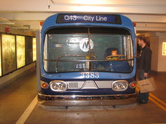
Sunday, two others and I went over to Brooklyn to visit the New York Transit Museum, underground in a former subway station. It included an extensive exhibit on the subway system’s history and day to day operations of the nation’s largest transit agency. At track level were a number of retired subway cars. Definitely a fun afternoon for me. That evening after regrouping with some others we went to see STOMP – quite the show.

Monday morning I got up early so I had about an hour to walk in Central Park. Even though we were staying a block away, I had yet to go inside the park on this trip. As I walked out of the Y, I could tell the city was bustling; the work week had begun. Around the corner was a school. I passed parents dropping off their children, some in SUVs, some in taxis. I saw other children walking. I thought to myself how profoundly different those kid’s lives are from mine as a kid.

I didn’t have a lot of time to go deep in to the park but walked over to the Mall and made it to the Bethesda Fountain. I stopped and sketched a moment along the Mall. A lot of people were out with their dogs. Soon enough it was time to head back and go to the airport. I got some breakfast at the terminal while we had about an hour to wait for departure. Our layover in Chicago was much longer this time, nearly three hours, so I walked through most of terminals – no small feat. We arrived back in Des Moines around 7pm, and carpooled back to Ames.

New York was a great trip. I got to do and see a lot, but missed a lot too. Certainly a city that warrants multiple return visits, but I have no desire to reside there. See all my photos on Flickr.

Travel by Train

Denver Union Station

I arrived back in Cedar Rapids this afternoon (Tuesday) after riding the Amtrak California Zephyr overnight from Denver to Mt. Pleasant, about an hour south of CR. The train was already running about three hours behind early on Monday when I checked the train status online. Scheduled to depart Denver at 8:10pm, the adjusted time was about 10:30. Around 10:15pm, the train had arrived and conductors began checking tickets and issuing boarding passes. Then we waited, and waited, and waited. Almost an hour went by before we boarded, as they were having some trouble adding an addition coach car to the train. Unfortunately no formal announcement was made concerning the issue, so the 50 plus passengers waiting to get on were unaware of the cause of delay.

When I finally boarded I got on car 611, second from last and went on upstairs to find a seat. I didn’t see any empty row so I took a seat near the middle of the train by the stairs, next to a man who had been riding since Saturday all the way from Seattle, heading home to Kentucky. Not sure why he was on the California Zephyr (he must’ve gone from Seattle down to California, then eastward on the Zephyr), when the Empire Builder is much more direct to Chicago going through Montana, North Dakota, and down through Minnesota and Wisconsin.

The train began moving by about 11:30, and I soon made my way two cars ahead to the lounge. At this point the upper observation level was pretty empty and the cafe on the lower level was closed until morning. The lounge car was peaceful and more comfortable than crowded coach. I also planned to watch some movies on my iPod and did not want to disturb my elder seat mate.

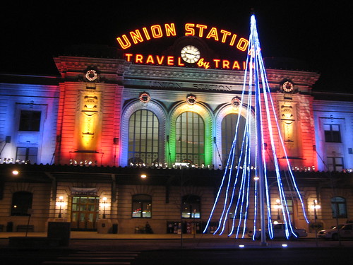
Heading out of Denver, eastbound, the train goes through rail yards and passes mostly industrial sites in Commerce City. The TAXI redevelopment caught my eye in particular, which Will Bruder discussed in his keynote speech last Wednesday at FORUM. The eastern gateway into Denver via rail is not particularly inviting, but most aren’t. Denver Union Station is impressive, though, providing a grand gateway right in to the heart of downtown. The interior is large, but pretty plain and outdated. The elegant exterior is more dramatic at night with the charming “Travel by Train” neon sign and colorful spotlights on the building’s stone walls.

Denver plans to turn Union Station into the city’s prime intermodal transportation center, centralizing Amtrak, SkiTrain, intercity buses, RTD transit bus and light rail. This is already in progress with the C and E light rail lines terminus, endpoint for the Free Mall Ride shuttle, and several RTD bus routes. When completed it should be quite the place.

I woke up this morning around 7am, from the breakfast announcement. The northern sky to my left was a dim, gray blue, and a warm yellow glow from the sunrise to my right. It’s a pleasing view to wake up to – if you were able to fall asleep in the first place. I eventually went to the lounge car and had a hot breakfast sandwich. After reaching Lincoln and Omaha, a number of seats opened up so I moved across the aisle to two opens seats and was able to sleep for a few more hours.

I arrived at my destination, Mt. Pleasant, Iowa, around 4pm, just about five hours late. An announcement had been made earlier by the conductor that nearly all connections would be missed in Chicago, and emphasized our safety was their top priority. He asked us to, “Sit back, relax, and enjoy our train trip through the breadbasket of America” – how cute.

Overall I was satisfied with my experience this time on Amtrak, but then again I was anticipating delay and understand their current situation. The consistent issue of lateness on certain Amtrak routes is somewhat out of their control. The majority of trains, especially cross-country ones like the California Zephyr, operate on track owned by freight railroads, whose operations get priority over Amtrak. As far as service, all train attendants were generally pleasant and tried to keep passengers happy considering the significant delay. In today’s case, they were offering a complementary meal in the afternoon (served after I deboarded), but I was able to benefit from a complimentary snack just before reaching Mt. Pleasant.

I have ridden Amtrak in the past, mostly on the California Zephyr, but also once on the Three Rivers (now defunct I believe) to Pennsylvania, and one short trip on the Empire Builder from LaCrosse to Fargo. It is quite obvious Amtrak service has gone downhill over the years. It is not terrible, but there are a lot of band-aids, it is merely getting by.

Passenger rail service is a critical part of our nation’s transportation system and needs to be reinvested in and expanded. Amtrak provides transportation access to numerous small communities that may be hours from a commercial airport. Train travel is also much more efficient and more affordable than flying. While cross-country train travel is no longer practical for most people, it makes a lot of sense regionally between distances about 500 miles or less. Not only is it easier and less stressful than flying, rail typically takes passengers right into the center of cities, unlike airports that tend to be located miles away from downtown.

Midwest High Speed Rail Association

Several states, such as Illinois and California have partnered with Amtrak to expand passenger rail service. Regional associations have been established to promote regional high speed rail networks around the country. The Midwest High Speed Rail Association, which includes Iowa, promotes an expanded regional network originating from Chicago and providing more frequent service to more locations throughout the midwest. The proposal includes a new line that would run through the Quad Cities, Iowa City, and Des Moines, through to Omaha. A new line from Chicago to Dubuque is currently the most promising for Iowa in the works right now.

Amtrak and passenger rail service deserves much needed investment and support from the federal level. It is a matter of national security, sustainability, and accessibility. It is my hope that we will see much greater support for Amtrak and alternative transportation from the new Obama administration.

Thanksgiving in Chicago

Hyde Park street

I was in Chicago for a few days over Thanksgiving week with my brothers family. I was able to get down to Hyde Park and walk around a bit – even passed by Barack Obama’s home. The scale of this neighborhood is charming and pleasant. Dense, but not overbearing, it provides a harmonious mix of quiet residential streets and walkable, diverse commercial avenues.

One evening I went with my brother to visit his friend who lives in Wicker Park neighborhood just northwest of downtown. A little bit louder and eclectic than Hyde Park (at least on the main commercial streets), the fellowship of cheap furniture stores, numerous bars, apartments and townhouses was great. Within the neighborhood a small urban park – appropriately called Wicker Park – provides some communal open space for nearby kids and adults – surrounded by active edges.

Saturday afternoon before leaving town, one of my brothers and I took the Red Line north to Addison to see Wrigley Field. Just a quick stop so we just walked around the stadium. To the south is a built up commercial strip with many bars and restaurants endeared, I’m sure, by thousands of Cubs fans. Townhouses and apartments to the north and east all have “Beyond the Ivy” stadium seating on the roofs – as well as advertisements visible from within the stadium. The neighborhood to the east of the Red Line (which is about half a block east of Wrigley Field) is inhabited with handsome brownstones and townhouses. The view from the train was a peak into another nice urban neighborhood of Chicago.

See all my photos from Chicago on Flickr.

Exploring the Cities and Prairies

We returned to Ames today from the Twin Cities. Here’s a recap of the past two days since I posted an update on Sunday.

Guthrie Theater

Sunday
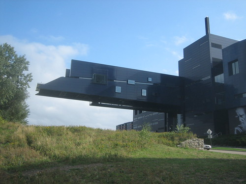
That afternoon we checked out the Guthrie Theater with its incredible cantilever that juts out toward the Mississippi River, providing a terrific view at the end. Outside the building was sleek and intriguing, but the inside just felt unorganized and random. The view made the stop all worth it though.

Afterwords two friends and I headed toward downtown St. Paul as the rest of the gang returned to the hotel before dinner. We took the light rail from the Metrodome down to 46th Street Station to transfer to Route 74. I had wanted to stop in the Highland Park neighborhood in St. Paul on the way (otherwise we could’ve just taken Route 16 direct from downtown to downtown) but for lack of time I decided ahead that a drive through on the bus would be sufficient. I was right.

We got off downtown next to the Xcel Engergy Center with a clear view of the Cathedral of Saint Paul sitting high above downtown. We trekked up the hill and went in for the last half of mass. It was interesting to experience both the cathedral and St. Paul and the basilica in Minneapolis. For dinner I met our other friends downtown to transfer to another bus to go to Boca Chica, a great Mexican restaurant hidden away in the District Del Sol neighborhood across the river from downtown.

Monday
Monday morning we checked out the Minneapolis Rowing Club Boathouse along the Mississippi at the Lake Avenue bridge. I left the boathouse early so I had sometime to look around the adjacent neighborhood along Lake Ave. It is a light commercial street that stretches east to west across the city, encompassing Midtown and Uptown. Right by the river where we were, it was predominantly residential just off on the side streets. They were modest streets with modest homes, generally well kept. It felt familiar, like a typical upper midwest, older neighborhood with bungalows and tree lined streets.

Following the boathouse, we were bussed to Lake Calhoun (couldn’t go to Minnesota and not see a lake now) where we spent an hour or two walking around on the path. Despite a separate “high speed” (as one professor tagged it) bike path and a generous walking path, there were still a number of cowpaths around the lake. For a while I decided to walk on one next to the paved path because it seemed like the thing to do.

Lake Ave in Uptown, Minneapolis

Next we were bused back into Uptown along Lake Ave for lunch. My friends and I enjoyed a rooftop lunch at Stella’s Fish Cafe. We decided to dip out of the rest of the day’s planned activities (bussing out of town to see Jackson Meadow and Fields of St. Croix – essentially suburban housing developments planned with open space) and stay in the metro. It was warming up and seemed a shame to leave the city and spend two or three hours on a bus. Unfortunately all we ended up doing was go to the Mall of America, but it was another chance to ride the light rail and it was nice to get away for a bit.

In the evening a few of us met my friend Eric’s friend who goes to the U of M for a campus tour. What a great campus and great urban atmosphere surrounding. We started in Stadium Village (mixed, commercial district in area of original athletic stadium – and UM’s new football stadium under construction) on the east end of campus and made our way toward the mall (central green) by the gopher-shaped Memorial Union and landmark University Avenue bridge over the Mississippi River. The smaller east bank of campus is completely car free so designated bike routes are traverse the plazas and sidewalks. UM’s campus really puts Iowa State to shame – it is so much more dynamic and intricate – and Campustown does not even compare. For supper we enjoyed “Leaning Tower of Pizza” in Stadium Village – good but very small pizzas – conveniently next door to our hotel.

Tuesday
We checked out earlier this morning and bussed over to St. Paul to the Bruce Vento Nature Sanctuary to the southeast of downtown. It was pretty much just a big swath of prairie grasses but was adjacent to the railroad tracks and had great views of the skyline. An old abandoned depot provided much more interest for the architect students. I again went off early and explored to adjacent residential neighborhood. The houses were well kept – some large and stately, others more modest. Once I crossed a pedestrian bridge over the freeway it was not quite as nice, but certainly not a horrible area. I walked a few blocks further to a corner grocery store for a Dr. Pepper and then headed back to the buses.

Onward to Iowa… we stopped once again a few hours later at – get this – another prairie. We had an hour and a half or so to explore the Fossil Prairie Preserve, 400 acres of native prairie and wetlands. An old fossil quarry was left as is, which was fun to climb down in and explore. We got back to Ames a little before 5pm. Check out all my pictures from the trip on Flickr here.

Update from Minneapolis

Day 2 of the field trip. Yesterday morning we stopped in Owatonna to see Louis Sullivan’s bank building, but more enjoyable was the local farmers market going on across the street at the city’s Central Park square. People selling produce, baked goods, and various crafts lined the sidewalks on the outside of the park with the interior green space left open to sit and watch. Their downtown appeared quite active and actually quite sizable for a city of its size. My previous impression of Owatonna – based on the quick drive through on I-35 – has been completely reversed. Downtown and the established neighborhoods are pleasant and the residents are friendly.

Once we got to the Cities we visited Minnehaha Park and Saarinen’s Christ Church. Minnehaha Park was beautify with a wonderful waterfall and paths. Apart of a larger riverside park stretching south from downtown, the park also had a restaurant and was quite active. Also conveniently next to the 55th Street light rail station. Christ Church was interesting to see, but every detail was not as significant as the tour guide seemed to believe.

For dinner we walked up University Ave to Dinkytown, UM’s larger and better version of Iowa State’s Campustown. We walked into campus a bit and checked out the UM College of Design building – also designed by Eero Saarinen, with an addition by Steven Holl. Afterwards a friend and I took Route 16 to downtown Minneapolis and explored for a few hours. Some streets were pretty lifeless while other areas were full of activity. Nicollet Mall near Target as well as further north in the Warehouse District appeared to be the hotspots for downtown nightlife.

This morning we checked out the Walker Art Museum. Another friend and I went across the street to the Basilica of Saint Mary for mass. Neither of us are Catholic but it was amazing to see the massive basilica (first one in the United States) and mass was interesting. The recessional hymn was awesome inside the vast space.

This afternoon, heading to downtown St. Paul and stopping in the Highland Park neighborhood on the way. We also plan to check out the architecture of Summit Ave homes near downtown. Check back later for images and more posts.

Exploring Hyde Park

Like I said, I was in Chicago a week or so ago visiting Hyde Park for a transportation node project for studio. Our project site is centered around 57th Street and the Metra station so this is the area I spent the most time in. This area was largely residential with just a few cafes, small bookstores, and grocery stores. We were in the neighborhood both Sunday and Monday to see any variation between weekday and weekend activity.

Hyde Park encompasses the campus of the University of Chicago, the Robie House, and the Museum of Science and Industry along with great parkland along Lake Michigan that was the site of the “White City” for the 1893 Columbia Exposition. The neighborhood developed starting in the mid 1800s around the Illinois Central Railroad which is the present day Metra line.

57th Street between Kimbark and the Metra tracks is a nice mix of small businesses, town houses and apartments, a school and a small park with a playground. It felt like a perfect example of a good urban neighborhood. The days of visit were very cold so not many people were out and about. I was drawn to the block by the school and playground; across the street is a small strip of businesses including a bakery, small grocery store and a floral shop among others. Although 53rd Street a few blocks north has many more businesses, this block serves as a micro-center for the immediate blocks around it. The park and school act as a public gathering space and the shops provided daily amenities, surrounded by dense but comfortable townhouses and small apartment buildings.

The blocks around 57th Street were not very busy early Sunday afternoon. There were a few dog walkers here and there and some college student indulging in childhood fun at the park’s playground. The couple of cafes and restaurants on 57th were open for business as well as a charming used bookstore. While looking around at the bookstore a few UC students came in to look at the store’s random stock of used suite jackets. Two women stopped in for a few minutes but decided not to buy anything that day; evidently they were regulars.

Expecting bustling streets during the weekday, Monday came with a bit of a let down. 57th. Street was not packed with pedestrians, but businesses and the school were running as normal. Vehicular traffic was slightly higher when we arrived back in the neighborhood around 9am. A cyclist was locking up his bike to a sign post. A woman parked her car to patronize one of the local businesses. Recess time – school children took over the playground that UC students had occupied the day before. As I walked by the corner cafe it was full and alive with a range from business people to blue collar. Today’s activity was very routine – just another morning in the neighborhood.

I really enjoyed the small neighborhood park. It had many pathways leading into the playground with long wooden benches placed to the sides. The benches were not the most attractive and the paths were not pristine but they proved functional and usable. I would choose this charming active, but imperfect neighborhood park over a lifeless, perfectly landscaped suburban park any day.

The Metra tracks form a physical and psychological barrier between the dense neighborhood of Hyde Park to the west and the open park space to the east along Lake Michigan. Walking from the neighborhood through the 57th Street underpass was like the entrance to Frank Lloyd Wright’s Robie House about 6 blocks away. Businesses and apartments were built up right against the Metra tracks. The overpass was dark and cool with multiple arcades of small arches and columns. The underpass is low and constricting, pushing one through the space. An opening above in the center provides relief, allowing some light in. On the east, one is released into the very open boulevard of Stony Island Avenue and Jackson Park. The monumental Museum of Science and Industry building can be seen beyond the park.

The Metra station and its overpasses over 56th and 57th streets are gritty and a little dirty. The platform provides wonderful views of the immediate blocks. It gives a glimpse into what the neighborhood might hold to a first time visitor like myself. A lot of trash and junk cars along the adjacent street give the impression that the neighborhood will be dirty and unkept. However that is not the case. The streetscaping and building facades along 57th and subsequent cross streets are pleasing and at an appropriate human scale. Homes and businesses open out to the sidewalk encouraging active streets and community interaction. Interestingly the implementation of a newer, modern townhouse project directly across the street from the Metra tracks challenges this common idea of where public activity should take place. Surrounding an interior courtyard, with garages facing the existing public street, these townhouse do not encourage the kind of street activity the older buildings and homes do. Many of the small garage and yard areas facing the street looked under-maintained and were scattered with litter. The whole area right around station felt barren and unwelcoming. I believe this is largely due to the orientation of these town houses.

The beauty of Hyde Park is in its diversity, of land uses and people. College students, life-long residents, rich and poor coexist in harmony here. The neighborhood’s massing and density benefits pedestrians, cyclists, and transit users, while still providing relative convenience for those with private automobiles. The sidewalks are pleasant and safe to walk on. The streets are narrow enough to not overwhelm pedestrians and cyclists yet wide enough to provide parking in most places. Hyde Park is a great example of a vibrant, sustainable, urban neighborhood – the kind of place where I would love to live and raise a family someday.

See all my Hyde Park and Chicago photos here.

Believe in Baltimore?

We visited Baltimore on Wednesday, March 13, over spring break. We took the MARC Penn Line train from Union Station in D.C. to Penn Station north of downtown Baltimore. First of all, Union Station is truly a jewel among American train stations. It was at risk of being lost just a few decades ago, but today it is a vibrant center complete with specialty stores, a food court, and even a movie theater. It is definitely something Washington can be proud of and a grand entrance to the city.

The ride to Baltimore wasn’t too exciting, just a few suburban commuter stations and a stop at BWI Airport. Coming into Baltimore, the view was of endless rowhouses, empty streets, and masses of trash and litter aside the tracks. The platform at Penn Station is outside on the back end of the building and certainly is not the grand entrance into Baltimore like Union Station is to D.C. After walking up a flight of old, worn stairs a hallway leads to a large waiting area at the front. This space has some grandeur but there is no one there. With no restaurants or stores at the station there is really no reason for travelers to linger there much. The exterior of the station is pretty nice but there is a huge, ugly statue blocking it, standing tall in the center of a taxi drive-thru circle in front of the terminal.

Penn Station is located at the north edge of downtown, maybe 20 blocks or so from the Inner Harbor. We started heading south on Charles Street, which leads in to the “cultural hub” of Baltimore at Mt. Vernon Square. On our way there, most of the buildings were older of course, no buildings very tall at this point. Most of the sidewalks consisted of a haphazard combination of old bricks and concrete. The streets were not in the best visual condition either, most with numerous patches. There was not a whole lot of activity in this area but there were a couple buildings we past that were being worked on for renovations, so that is a good thing.

At Mt. Vernon Square, Charles Street divides into two sides and a narrow green space exists between it. In the very center is the Baltimore George Washington Monument, actually built before the one in D.C. It is basically a round tower with a slightly wider, circular base. It was actually open and we were able to walk up a long spiral staircase to the top where there are windows to look out over the city. The interior of the tower had a lot of writing on from past visitors, but the exterior and base of the monument is well kept, which really is the most important.

Mt. Vernon Square is surrounded by the Peabody Library and a number of other museums and cultural elements of Baltimore. At the northeast corner of the square sits the historic Mount Vernon Square United Methodist Church made with various types and colors of stone, including green serpentine marble, giving it a dark green/brown appearance. It’s towering steeple at the corner gives the square two visual high points. Mount Vernon Square is certainly nice but for being the cultural and in some sense, the “best” part of Baltimore, it could use some improvements. In general much of the green space, especially north of the monument is featureless and not really utilized. Since the most surrounding buildings aren’t more than five or ten stories tall, the space feels very open and almost vulnerable. Being fairly close to the barren area around Penn Station and a freeway slicing through just a couple blocks to the east, the square is not as cozy and secluded as I would like.

Heading further south to the harbor, we entered the more built-up core of downtown with more skyscrapers, some old and some newer. The massive Charles Center complex stands out like a soar thumb and looks completely mix-matched and awkward. It was an urban renewal project back in the day, including office and residential towers. One Charles Center is the prominent office building, designed by Mies van der Rohe. Usually I’m not a big fan of Modernism, but I really don’t mind this one, especially in contrast with the other buildings in the complex. A few of them are starkly unattractive, especially one of the residential buildings that appears more like public housing projects than desirable apartments. Another slightly newer residential building reminds me of a retirement home in Fargo, only much taller.

Much of the complex is situation at an angle to the historic street grid and there aren’t any through streets through the super block it took for itself. The angles of the building create confusing inconsistency on the traditional grid of downtown and the city as a whole. It also makes the skyline view a bit awkward if you ask me. At the base in the center area is a low rise, newer development that doesn’t seem to belong at all. Like the rest of the Charles Center, it gives little respect to the street grid and forms its own random public space in the front. The building it self looks like a short suburban strip center without the parking. There is no defined roof level with a bunch of haphazard elevated portions, I imagine for mechanical purposes. We walked through part of the super block, which was quite inactive in the middle. Perhaps they shouldn’t have closed off the streets…

Note: This is an incomplete post.
See all my photos of Baltimore here.

Fear the Turtle


Well it’s now been three weeks since spring break. I haven’t been doing well posting about it in a timely manner, but better late than never. Three weeks ago on Tuesday, March 12, we took the Metro to College Park and explored the University of Maryland campus. The University of Maryland, College Park is the flagship university of the University System of Maryland and is considered a “public ivy” school, ranking quite well for a public institution. I am considering Maryland for graduate school in urban planning once I finally complete architecture school in 2011.

The College Park Metro station is a suburban commuter station, complete with a parking garage. It is somewhat disconnected from campus and the city itself. We walked about 15 minutes along Paint Brach Parkway before arriving at Route 1 / Baltimore Avenue, the main drag through town, and the front of the university. We continued into campus along Campus Drive and passed the big “M” in flowers in the center of a traffic circle. From there we went by the McKeldin Mall, the heart of the university and campus. It is much larger than I had expected and a lot hillier. The campus slopes up quite significantly from Route 1 on the eastern edge. The Mall was very active with many students relaxing or playing frisbee. This is definitely a very usable space on campus.

On the east end of the Mall is the Main Administration Building and on the west end is the McKeldin Library. Numerous academic buildings line the sides, all in dignified Georgian architecture. An allee of trees on each side of the Mall creates two formal walkways. They are retreatful and intimate in contrast to the wide-open Mall. In the center of the Mall is the 250-foot long ODK fountain, which water flows down various levels following the downward slope of the land toward Main Administration. Walkways radiate out from one end of it and many benches are placed along its sides. Unfortunately there was no water in the fountain yet for the season.

The Architecture Building is a newer, non-Classical building built in 1971. Clad in brick, it appears somewhat dated but is not too bad. Located just southwest of the McKeldin Mall, it is away from the more historic part of campus, but not totally disconnected either. Behind it is a large parking lot at the backside of campus. The building seems pretty small, almost too small to accommodate the whole department. I’m not exactly sure how much all the programs in the college actually utilize this building though. Inside the main part is a two story open space with classrooms on the second level and open studio space on the lower level.

We ate lunch at the food court in the Stamp Student Union, just north of the McKeldin Library. The food court is located in the center and is easily accessible from the outside. Unlike the food court in Iowa State’s MU, it is not hidden away in the basement and also offers many more choices, not just made up franchises operated by dining services. After lunch we walked around Byrd (football) Stadium and some high-rise dorms behind it. The high-rise dorms are extremely plain, somewhat resembling housing projects. However they are clad in brick and the entrances include some basic Classical elements.

Overall, the Maryland campus is very unified and distinguished. Most buildings were designed with Georgian or Classical architecture and new buildings continue to respect that. A few newer buildings are notably simpler, especially some of the dormitories as mentioned above, but nearly every building is clad in brick. One could argue that campus lacks architectural diversity, but I appreciate the consistency and the Classical charm it preserves. Additionally, it helps prevent a lot of fad architecture (such as modernism) being built on campus, which usually are not timeless and eventually considered unattractive.

The University of Maryland campus is certainly impressive, but the same cannot be said for College Park. We didn’t venture very far away from campus, but there is very little that surrounds it. Downtown College Park is along Route 1 at the southern tip of campus. It is little more than a few blocks of small strip buildings with typical college town businesses. In that regard it is somewhat analogous to Campustown in Ames, but it was much less active and less built-up. The fact that it is just a small stop along Route 1 in the sprawling suburbs of Washington doesn’t really help. Fortunately there does seem to be some hope for College Park. The University is in the works of a large redevelopment project on land across Route 1 from campus. The East Campus Redevelopment Initiative will replace a number of maintenance and university service buildings with a dense, mixed-use neighborhood. Hopes are that this will improve College Park for both students and residents, transforming it from a lackluster suburb to a vibrant college town. There are also a number of other developments underway in College Park and surrounding. More information is available at the Rethink College Park blog, which I enjoy reading.

See all my photos of College Park here.

Older posts Newer posts

© 2022 URBAN THINKING

Theme by Anders NorenUp ↑